|
|
Community Air Monitoring in East Oakland
Learn about the Air District's efforts to conduct air monitoring in East Oakland.
Background
The Air District, Communities for a Better Environment (CBE), and the University of California, Berkeley (UCB) partnered to implement a multi-year community air monitoring project in the community of East Oakland. The project was partially funded by a grant from the US Environmental Protection Agency for enhanced air quality monitoring for communities.
Located near the East Bay waterfront, East Oakland contains large tracts of industrially zoned land with a mix of stationary industrial sources that are often directly upwind of residences and schools. East Oakland also is a major transportation corridor with goods moving via ship, rail, congested freeways, and truck routes in close proximity to people’s homes. This area includes Interstate 880, Oakland International Airport, and industrial and logistics businesses associated with the Port of Oakland.
East Oakland community members and organizations have long advocated for health equity, cleaner air, and investments to promote a green and regenerative economy, and this air monitoring project aids those efforts. The project used a multifaceted approach for characterizing local-scale air quality impacts in East Oakland, including:
- The Air District’s air monitoring van measured volatile organic compounds (VOCs) – including many air toxics – and particulate matter (PM) around pollution sources or community assets of interest to the community,
- Follow-up measurements as needed to investigate questions raised by the initial measurements, and
- Deployment of a network of outdoor and indoor commercial PM sensors and DIY air filtration units to community members and schools, who were trained to interpret data and respond to air quality emergencies, such as wildfire smoke events.
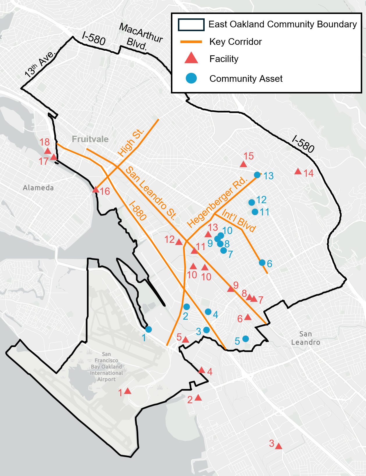
Air monitoring using the Air District’s air monitoring van was focused around facilities, key corridors, and community assets that were identified by the East Oakland community, illustrated in the map below.
|
▲ Facilities
|
● Community Assets
|
Monitoring Project Documents and Materials
To learn more about the project and how to get involved, subscribe to our email list using the link on this page and check this page for information and updates as the project progresses.
You may also contact CBE for more information about the project.
Community Air Monitoring in East Oakland Email Signup
SUBSCRIBE
This project has been funded in part by the United States Environmental Protection Agency (EPA) under assistance agreement 98T56701 to the Bay Area Air Quality Management District. The contents of this website do not necessarily reflect the views and policies of the EPA, nor does the EPA endorse trade names or recommend the use of commercial products mentioned on this website.
East Oakland Monitoring Project Signup
East Oakland Monitoring Project
Last Updated: 15/07/2026